Showing posts with label car-free. Show all posts

Wednesday, 24 December 2014

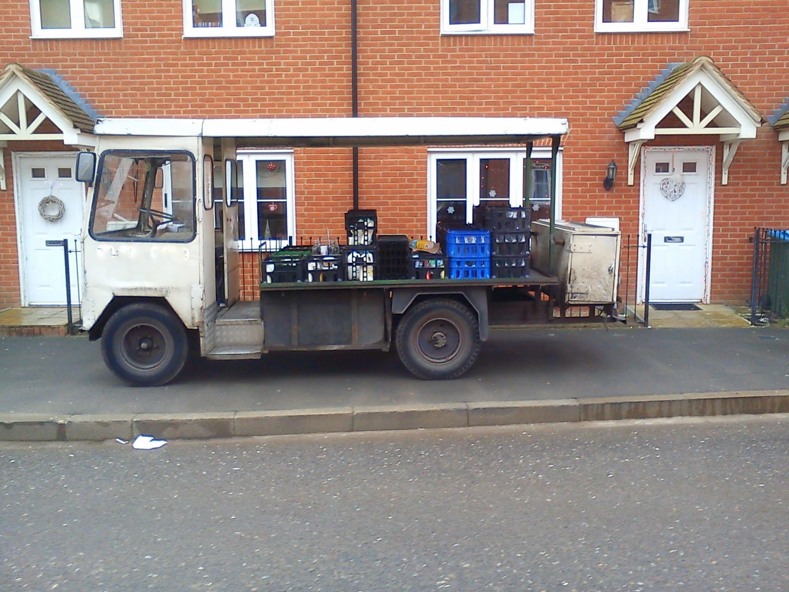
Urban Deliveries - The Humble British Milk Float

The humble British Milk float,
The most successful electric vehicle ever built?
Discussing urban infrastructure with some friends, it occurred to me that folks outside the UK may not be aware of the humble British milk float.
I remember growing up in the early 1970s and seeing these on the streets then.

There are a couple of variations in the design, including some with only one front wheel, and one headlight, and a more ponted front end than the squarer milk float shown above.
Sometimes petrol (gasoline) powered vehicles are used for milk delivery, particularly in rural areas, but the "classis" milk float is a battery-powered vehicle, with a string lower frame (to take the weight of the batteries!) and a lightweight upper body.
Some have plastic/grp bodywork, and some have metal bodywork, and some have side door (or no doors at all!) rather than the rear-entry cab shown above.

Such vehicles have a top speed of about 20 mph (32 km/h) and I remember cycling to work about 30 years ago on an unlit road being chased by this eerie light, I cycled faster and faster and was able to stay well in front of it. When we got to the next section of raods that had streetlights, I saw that I was being followed by a milk float (a single-headlight model).

So what is the relevance of this now?
Well, two things really:
Firstly, the electric milk float is probably THE most successful electric vehicle ever made;
Secondly, when we are thinking about how our towns and cities should be planned in the future, we need to think about what services (if any) we wish to provide.
For example, should we allow milk floats into cuty centre areas, but only before, say, 7 am?
In my experience, milk floats usually deliver somwhere between about 5 am and 7 am, 6 days a week.
Is that what we want in our cities?
Does having door-to-door milk (or whatever) deliveries mean that urban citizens cut down on car use as a result?
We discuss such things over on the Car-Free Cities community, and there is a currently a survey about ... (wait for it) ... milk floats.
Why not join us, and share your views!

Saturday, 22 November 2014

How does your town/city rate for non-car infrastructure?


Map from "OpenStreetMap", but the annotations are mine.
Blue = schools for under 11s ("primary"), Red = supermarkets, Black = train stations,
Green = bus stations, Purplr Line = Bourg Walk bridge
For those of you that want to know what it is like living in a compact town ... (there is a scale, bottom left). To put it in context, the urban area of Aylesbury shown on the map above has a population of in the region of 75000. (new housing is still going up, so the census number from 2011 is like to be on the low side!)
This is where I live - Aylesbury. I live near the big "x" on the north-east side of town.
The blue dots are schools for the under 11s (three are "special schools" for those who, due to learning disabilities etc. need lots of extra support - and tbh, I think one of the three I have marked is for the older kids - so that's two for the younger kids).
The red squares are the supermarkets - EVERY major British supermarket chain is represented in Aylesbury. There are, of course, local, smaller, food stores on top of that.
Gotta be copyright of Chiltern railways, but I'm sure they won't mind me sharing their route map.
the map is about 7 years old, and there is now a second railway station in Aylesbury that is not shown.
It is Aylebury Vale Parkway, which is just a bit further up the spur that leads to Aylesbury.
The two black marks are the two railway stations - both connect to London (Marylebone), which is VERY close to Baker Street and the Madam Tussaurds waxworks venue. There is an alternative route that connects (via a change) to Birminham, and thus, to the rest of the country's rail network.
Map copyright Arriva, showing the Places one can get to with
an "All Zones" pass.
The green square near one of the railway stations is the Bus Station.
The purple line near the Bus Station is the "Bourg Walk", the $12.8 million walking and cycling bridge that was built a few years ago as the centrepiece of the town's cycle program.